Mapping of the asbestos roofings
Terrasystem supported DISAFRI - University of Tuscia in the acquisition and processing of data within a study of methodologies of remote sensing by light airborne platform to support the mapping of asbestos roofing in some areas of the province of Viterbo. The project was carried out under a research agreement signed with the ASL (regional health agency) - Prevention Department, Laboratory of Industrial Hygiene - Asbestos Regional Center.
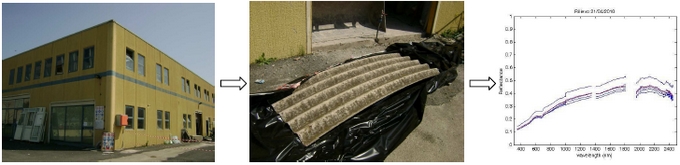
In some test areas a field survey, with which spectral signatures of materials containing asbestos (MCA) and replacing roofings (materials not containing asbestos, MNCA) were collected was carried out in order to radiometrically characterise the various types of material and, at the same time, to obtain information for the choice of the most suitable spectral bands and filters sets for the aerial survey
The campaign for the collection of the remotely sensed data was carried out in 2010 using the integrated DFR-ASPIS system.
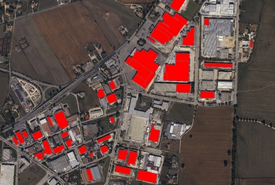
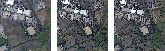
The data was radiometrically corrected and orthoprojected and then processed according to a classification methodology developed on object oriented techniques. As part of this methodology, a set of 'criteria' based on the spectral, geometric and textural characteristics of the roofings was developed, and 'membership functions' were parameterised in relation to a set of ground collected data used as training sites.
The result of the classification of the MCA was validated through confusion matrices. The accuracy regarding the surface correctly classified as MCA is higher than 95% while the accuracy concerning the correct number of covers identified as MCA is 87%.
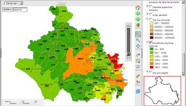
The final classification map was produced in vector format and integrated into a Geographic Information System (GIS) along with cartography and orthophotos. The surfaces of MCA of each municipality of the Province (absolute and pro-capite) were estimated on the basis of an analysis of the distribution of the asbestos roofing in the various land use classes, and the resulting statistic maps were included in the GIS