Company
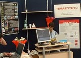
TERRASYSTEM was created in 2004 thanks to the idea of some Ph.D. and young researchers of University of Tuscia (Viterbo - Italy) and the National Research Council CNR IBIMET of Florence, with the aim of experience building upon years of experience in the field of geomatics.
TERRASYSTEM is well rooted in the field of national and international research, and collaborates steadily with Universities and Research Institutes in the development of aerial data capture systems and techniques of data processing.
The TERRASYSTEM staff are highly specialized in geomatics, and have all the required skills for research applications as well as specific experience in the fields of environmental monitoring, agricolture, forestry and engineering.
TERRASYSTEM has worked in collaboration with: the National Research Council CNR IBIMET (Italy), the Italian National Agency for New Technologies, Energy and Environment (ENEA), the University of Tuscia (Italy) and the University of Southampton (UK), Alterra (NL), the University of Strasbourg (FR), Agriconsulting SpA, Litorale SpA, BIC Lazio SpA (Italy).


