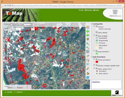
ToMAP project: mapping of the industrial tomato crops of central and southern Italy
Since 2013 Terrasystem, under the supervision of DIBAF - University of Tuscia, has carried out yearly the mapping of the industrial tomato crops of central and southern Italy on behalf of Anicav.
All the crops within the relevant areas for production of central and southern Italy (a total area of approximately 15,000 km2) has been estimated and mapped, with reference to crops that has been transplanted between late May and 10 June.
The map was produced by an integrated process of classification using different types of satellite multispectral data, some of which were acquired on-demand and, for the areas of greater production, using aerial data. For the 2016 mapping a new processing methodology has been developed, based on new multispectral satellite Sentinel 2 of the ESA.
The classification of the images was performed by supervised and machine-learning type approaches, with the support of a robust campaign of ground surveys. The final product was a vector map of the tomato crops, 1:25,000 scale, which has been integrated, together with cartography layers (color orthophotos, roads, etc.), in the ToMAP WebGIS, implemented by Terrasystem by open source technologies.