 webgis flyer (ita)
WebGIS
Applications:
- Municipal administrations: publishing and sharing of basic and thematic cartography, cross spatial analysis, management of the real estate register, certifications (with the integration of cadastral and topographic maps)
- Environmental protection: management of urban green spaces, management of the Forest Fires Cadastre
- Civil Protection: classification of areas at risk, support for plans of civil protection
- Network infrastructures (aqueducts, power grids, sewage etc.).
- Agri-environment: publication of maps and data in support of agricultural production and forestry, weather data
- Tourism: promotion of local resources, cultural heritage and typical products
FEATURES
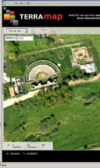
These applications are based on the most advanced development tools with proprietary or open source license.The system allows for the continuous updating of the geographic database and their integration with databases already owned by the institution. It is also possible to integrate very high resolution aerial ortho-photos produced by Terrasystem.
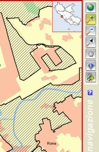
- Tools for the interactive browsing of maps
- Geodatabase advanced query functions
- Tools to upgrade or expand the database on-line
- Tools for creating and printing documents
- Customisable graphic interface and features
- Flash-based interface for greater interactivity
- Management of different categories of users (back-office, front office etc.)
- Ability to view contents in Google Earth and Maps
- Map formats also compatible with existing GIS