Spatial models MOD17 and Century for the GIS of Sardegna
In line with the development of the Geographic Information System for the monitoring of the areas of the region of Sardinia at risk of desertification, carried out by Agriconsulting SpA and ESRI Italia SpA for Regione Autonoma della Sardegna, Terrasystem was responsible for the development and implementation of two intermediate models for the estimation and the spatialization of the organic carbon present in the soil as well as plant productivity.
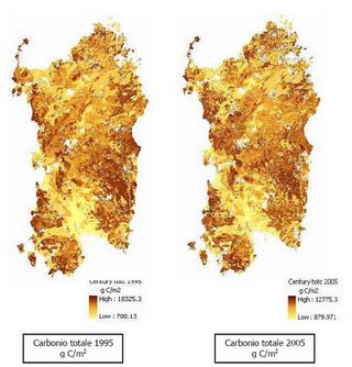
Century model
Century model, developed by Natural Resource Ecology Laboratory (NREL) of Colorado State University, is a process-oriented model designed to simulate the productivity essentially related to the dynamic of soil carbon in agricoltural ecosistems, but also in natural ecosistems as prairies and forests. For such application the model was used both in agricoltural and forest ambit.
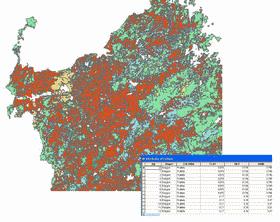
The presetting of the inputs required a database in GIS environment in which the region was split by overlay, recodification and spatial analysis operations, in omogeneous polygons relatively to the parameters connected with meteorological data, soil features, agricoltural and forest classes and their management.
The aim of the simulations was to estimate the change in levels of organic carbon content and Net Primary Productivity between two years of reference (1995 and 2005) and then to be able to estimate the future changes in relation with simulated climate scenarios.
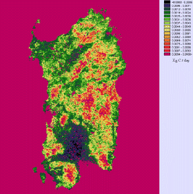
MOD17 model
The MOD 17 model, developed by Steve Running of the University of Montana - Missoula, was employed to estimate vegetation productivity expressed as Gross Primary Productivity.
This data-oriented model, based on remote-sensed and meteorological data, uses FPAR (fraction of incident solar radiation absorbed by vegetation) as input, which is calculated from processed data of MODIS (MOD15A2 product) or AVHRR NDVI (for the years previous to 2000) through operations of projection, mosaiking, cutting and gap filling of the different scenes. The 50x50 m geometric resolution (GIS specification) was obtained rescaling the original datum at a 500 m resolution, using an algorithm based on land use and distinctive reflectance of each class.